
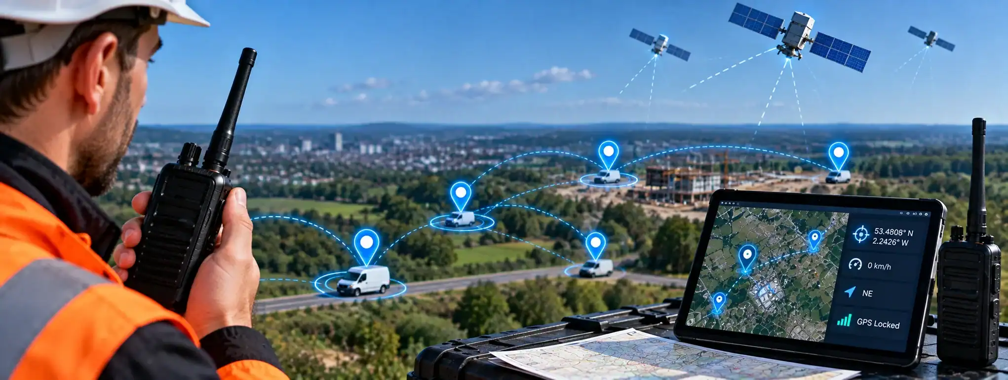
GPS (Global Positioning System)
GPS (Global Positioning System) is a satellite-based positioning system that allows compatible devices to determine their geographical location. In professional two-way radio systems, GPS can be built into radios to provide location information for applications such as fleet managementFleet Management is the process of managing a two-way radio fleet, including equipment, users, programming, maintenance, firmware, security and radio system configuration., dispatch, worker safetyWorker Safety refers to measures used to protect employees from workplace risks. Two-way radios can support worker safety through instant communication, emergency alerts, Lone Worker and Man Down functions. and asset tracking.
GPS can determine a radio’s approximate position using signals received from satellites. The resulting location information can then be stored, displayed on a map or transmitted through a compatible radio networkA Network is a connected system of radios, equipment and infrastructure that allows users to communicate across a defined area. Radio networks can range from simple radio-to-radio systems to large multi-site networks. to authorised users.
GPS is a positioning system rather than a radio communication system. A GPS-enabled radio still requires a suitable communication network if its location information is to be transmitted to another person or system.
How does GPS work?
GPS uses a network of satellites orbiting the Earth. The satellites continuously transmit timing and positioning information.
A GPS receiverA Receiver is the part of a two-way radio that detects and processes incoming radio signals, converting them into audible voice or usable data for the user. in a compatible radio or other device receives signals from multiple satellites and uses them to calculate its position.
The resulting information can include:
- Latitude
- Longitude
- Position
- Speed
- Direction
- Time
The exact information available depends on the device and software.
GPS in two-way radios
Some professional two-way radios contain an integrated GPS receiver.
This allows the radio to determine its geographical position without requiring a separate GPS device.
Depending on the radio and system, the location information may then be transmitted across the radio network to a dispatcher, control room or management platform.
GPS and radio communication
GPS itself does not transmit a radio user’s location to another person.
There are two separate processes:
GPS receiver → determines the radio’s location
Radio network → transmits the location information
A GPS-enabled radio therefore needs an appropriate communication path if its location is to be monitored remotely.
GPS and Dispatch
A Dispatch system can use GPS information from compatible radios to display the location of radio users on a map.
A dispatcher may be able to see where individual radios are located and, depending on the system, monitor their movement over time.
This can be useful for coordinating mobile teams and understanding the location of personnel during an operation.
GPS and Fleet Management
Fleet Management systems can use GPS to monitor the location of radios, vehicles or other mobile equipment.
For example, a transport company may use GPS-enabled mobile radios to provide location information about vehicles operating across different areas.
GPS can therefore form part of a wider fleet-management system.
GPS and Geo-Fencing
Geo-FencingGeo-Fencing uses GPS and a virtual geographical boundary to identify when a radio user or tracked device enters or leaves a defined area, triggering alerts or other actions where supported. uses geographical boundaries together with location information.
A GPS-enabled radio can provide its position to a compatible system, which can then determine whether the radio is inside or outside a predefined Geo-Fence.
For example:
GPS determines location → system compares location with Geo-Fence → boundary event is detected
The resulting action depends on the management or dispatch system.
GPS tracking
GPS Tracking is the process of using GPS location information to monitor the position or movement of a device.
In professional radio systems, GPS tracking can allow authorised users to see the location of compatible radios.
The frequencyAn antenna transmits and receives radio-frequency signals, allowing a two-way radio to communicate. Antenna type, frequency, height and location can all affect radio performance and coverage. at which location information is updated varies between systems.
GPS location updates
A GPS-enabled radio does not necessarily send its location continuously.
The system may be configured to send location information:
- At regular intervals
- When the radio moves
- When a specific event occurs
- When requested by the system
- During an emergency
Frequent location updates can provide more current information but may also affect battery usage and network traffic.
The available options depend on the radio and communication system.
GPS accuracy
GPS accuracy is affected by the radio’s environment and the quality of the satellite signals it receives.
Factors can include:
- Satellite visibility
- BuildingsAn antenna transmits and receives radio-frequency signals, allowing a two-way radio to communicate. Antenna type, frequency, height and location can all affect radio performance and coverage.
- Terrain
- Trees
- Indoor environments
- Atmospheric conditions
- Receiver design
A GPS position should therefore be regarded as an estimate rather than an absolutely precise physical location.
GPS indoors
GPS can be less reliable indoors because buildings can block or weaken satellite signals.
This can result in:
- Reduced accuracy
- Delayed position fixes
- Intermittent location information
- No usable GPS position
This is particularly relevant when GPS-enabled radios are used inside large buildings, underground areas or structures with limited satellite visibility.
GPS and buildings
Tall buildings and other structures can obstruct satellite signals or cause them to reflect before reaching the GPS receiver.
This can reduce positioning accuracy or cause the reported position to differ from the radio’s actual location.
The effect varies according to the environment and receiver.
GPS and emergency communications
GPS can provide useful location information during an emergency when supported by the radio systemA Radio System is a complete communication solution comprising two-way radios and, where required, equipment such as repeaters, antennas, base stations, mobile radios and network infrastructure..
For example, a radio may transmit its location when an Emergency AlarmAn Emergency Alarm allows a two-way radio user to quickly alert a dispatcher, control room or other authorised users that assistance may be required. or Emergency CallAn Emergency Call is a priority two-way radio function that allows a user to quickly request assistance and, on supported systems, establish an urgent voice communication with a dispatcher or control room. is activated.
This can help authorised control personnel understand where the emergency communication originated.
However, GPS location information should not be assumed to be available during every emergency. The radio must have GPS capability and a functioning communication path for the information to reach the intended recipient.
GPS and Man Down
Some professional radios combine GPS with Man DownMan Down is a safety feature on some professional two-way radios that can detect a possible fall or unusual radio position and automatically raise an alert if the user does not respond. functionality.
If a radio detects a possible fall or other Man Down condition, it can potentially send an emergency alert together with the radio’s location.
This can provide additional information to control personnel.
The exact functionality depends on the radio and system.
GPS and Lone Worker
GPS can complement Lone WorkerA Lone Worker is someone who works without direct supervision or immediate assistance nearby. Compatible two-way radios can provide safety features such as timed check-ins, emergency alerts and GPS location. functionality by providing information about the location of a lone worker.
For example, if a lone worker activates an emergency alert, a compatible system may be able to provide the worker’s most recently reported GPS position.
GPS does not replace the emergency or lone-worker function itself.
GPS and vehicle-mounted radios
Vehicle-mounted Mobile Radios can incorporate GPS to provide the location of vehicles.
This can be useful for:
- Transport
- Logistics
- Security patrols
- Service fleets
- Emergency operations
- Field services
The radio can transmit its location through a compatible communication network where the system supports it.
GPS and handheld radios
GPS-enabled handheld radios can provide the location of individual radio users.
This can be particularly useful where personnel move around large sites or between locations.
Examples include:
- Security teams
- Event staff
- Construction personnel
- Transport workers
- Field-service teams
GPS and DMR
Professional DMR (Digital Mobile RadioA Mobile Radio is a two-way radio designed to be installed in a vehicle. It normally uses the vehicle's power supply and an external antenna to provide reliable communication while travelling or working in the field.) systems can support GPS location services where compatible radios, network infrastructureRadio infrastructure is the equipment and supporting systems behind a professional two-way radio network, including repeaters, antennas, base stations, network connections, power systems and dispatch equipment. and software are available.
GPS information can potentially be transmitted using the radio network and displayed through compatible dispatch or fleet-management software.
GPS is not automatically available on every DMR radio.
GPS and digital radio
GPS is independent of whether the radio uses analogue or digital voice.
A radio must have suitable GPS hardware and software support to provide GPS functionality.
Digital radio systems can, however, provide data communication capabilities that allow GPS information to be transmitted as part of the wider system.
GPS and analogue radio
A GPS receiver can be included in some radio equipment regardless of whether the radio uses analogue or digital voice.
However, transmitting GPS information through an analogue radioAnalogue radio uses continuously varying radio signals to transmit voice communication. It remains widely used for reliable two-way communication across business, industry, events, security and other applications. system may require additional equipment or infrastructure.
The availability of GPS tracking therefore depends on the overall system rather than simply whether a radio is analogue or digital.
GPS and radio IDs
In a digital radio system, GPS information can be associated with a particular Radio ID.
This allows the management or dispatch system to determine which radio has provided a particular location update.
For example:
Radio ID 105 → GPS location → displayed as User 105
This can help dispatchers distinguish between multiple users.
GPS and mapping
GPS location information is commonly displayed using mapping software.
A dispatch or fleet-management platform can place radio users or vehicles on a digital map.
Depending on the system, the map may show:
- Current or recent position
- Movement
- Direction
- Geographical areas
- Geo-Fences
- Radio identity
- Alerts
The available mapping features depend on the software.
GPS and location history
Some systems can store previous GPS positions to create a location history.
This can allow authorised users to review where a radio or vehicle has been during a particular period.
The availability and retention of location history depend on the management platform and its configuration.
GPS and route tracking
Where a system records regular GPS positions, the collected information can be used to show the route travelled by a vehicle or radio user.
This can be useful for fleet operations and post-event analysis.
The accuracy of a route depends on how frequently the radio reports its position.
GPS and speed information
A GPS receiver can calculate the approximate speed of a moving device.
Some professional systems can use this information alongside location data.
For example, a fleet-management platform may display the location and movement of a vehicle.
Not every radio system provides speed information to users or dispatchers.
GPS and direction
GPS can also be used to determine the direction in which a moving device is travelling.
Where supported, this information can be displayed by fleet-management or dispatch software.
Direction information generally becomes more meaningful when the device is moving.
GPS and radio coverage
GPS and radio coverageRadio Coverage is the geographical area in which a two-way radio system can provide reliable communication. Coverage depends on the radios, antennas, frequency, terrain, buildings and system infrastructure. are separate considerations.
A radio may be able to determine its GPS position while being unable to transmit that information because it is outside the communication network’s coverage.
Conversely, a radio may have radio coverage but experience poor GPS reception.
A location-enabled radio system therefore needs both suitable positioning and communication capabilities for reliable remote tracking.
GPS and repeaters
A professional radio network may use a RepeaterA Repeater receives a two-way radio transmission and retransmits it, usually from an elevated location, to extend the coverage and reliability of a radio communication system. to extend the communication range of GPS-enabled radios.
Where the system supports data transmissionTransmission is the process of sending voice, data or signalling from a radio using a radio-frequency signal to another radio, repeater or communication system. through the repeater, GPS information can be carried across the radio network.
The exact implementation depends on the radio technology and network design.
GPS and cloud systems
GPS-enabled radios can provide location information to compatible Cloud ManagementCloud Management uses an online platform to remotely manage and monitor compatible two-way radios, users, devices and communication settings from a central location. or cloud-based dispatch platforms.
This can allow authorised users to view radio locations remotely through an internet-connected system.
Cloud location services require suitable radio connectivity and compatible software.
GPS and privacy
GPS tracking can involve collecting information about the location of people.
Organisations using GPS-enabled radios should therefore consider how location information is collected, accessed, stored and used.
Users should be informed about applicable location-monitoring arrangements where required, and organisations should handle location information in accordance with their policies and applicable legal requirements.
GPS and security
Location information can be operationally sensitive.
For example, the location of security personnel, vehicles or critical infrastructure may need to be restricted to authorised users.
Access controls and appropriate security measures should therefore be considered when implementing GPS tracking.
GPS and battery life
Using GPS and transmitting regular location updates can affect radio battery consumption.
The effect depends on:
- GPS receiver design
- Location update frequencyFrequency is the number of cycles a radio wave completes each second, measured in Hertz. In two-way radio, frequency determines where a transmission operates within the radio spectrum.
- Radio technology
- Network activity
- Battery capacity
- Other radio functions in use
For users working long shifts, the required location-update frequency should therefore be considered alongside battery requirements.
GPS and radio hire
GPS-enabled radios can be used for temporary radio deployments where the supplied equipment and software support location services.
For example, a large event may use GPS-enabled radios to help event control monitor the location of mobile teams.
The availability of GPS tracking, mapping and Geo-Fencing depends on the radio equipment and management system being supplied.
GPS limitations
GPS is not a guaranteed real-time location service in every environment.
Performance can be affected by:
- Buildings
- Underground locations
- Dense urban areas
- Terrain
- Poor satellite visibility
- Radio connectivity
- Battery condition
- Location-update intervals
For this reason, GPS information should be interpreted in the context of the environment and the capabilities of the complete communication system.
GPS and system design
When implementing GPS within a professional radio system, organisations should consider:
- Which radios require GPS
- Required location accuracy
- Location-update frequency
- Radio coverage
- Network capacity
- Battery requirements
- Mapping software
- Geo-Fencing
- Location history
- Emergency functions
- Privacy and data handling
- Who should have access to location information
The appropriate configuration depends on the operational purpose of the radio system.
GPS and DCS
DCS can provide professional two-way radio systems incorporating GPS, location tracking, mapping and Geo-Fencing where supported by the selected equipment and software.
These capabilities can be useful for organisations that need greater visibility of mobile personnel or vehicles.
The appropriate GPS solution depends on the radio equipment, coverage, network architecture and operational requirements.